PCT MILES COMPLETE: 2073.4
PCT mile 183.5 to PCT mile 76
Section mileage: 118.2
Days: 10/26 - 11/2
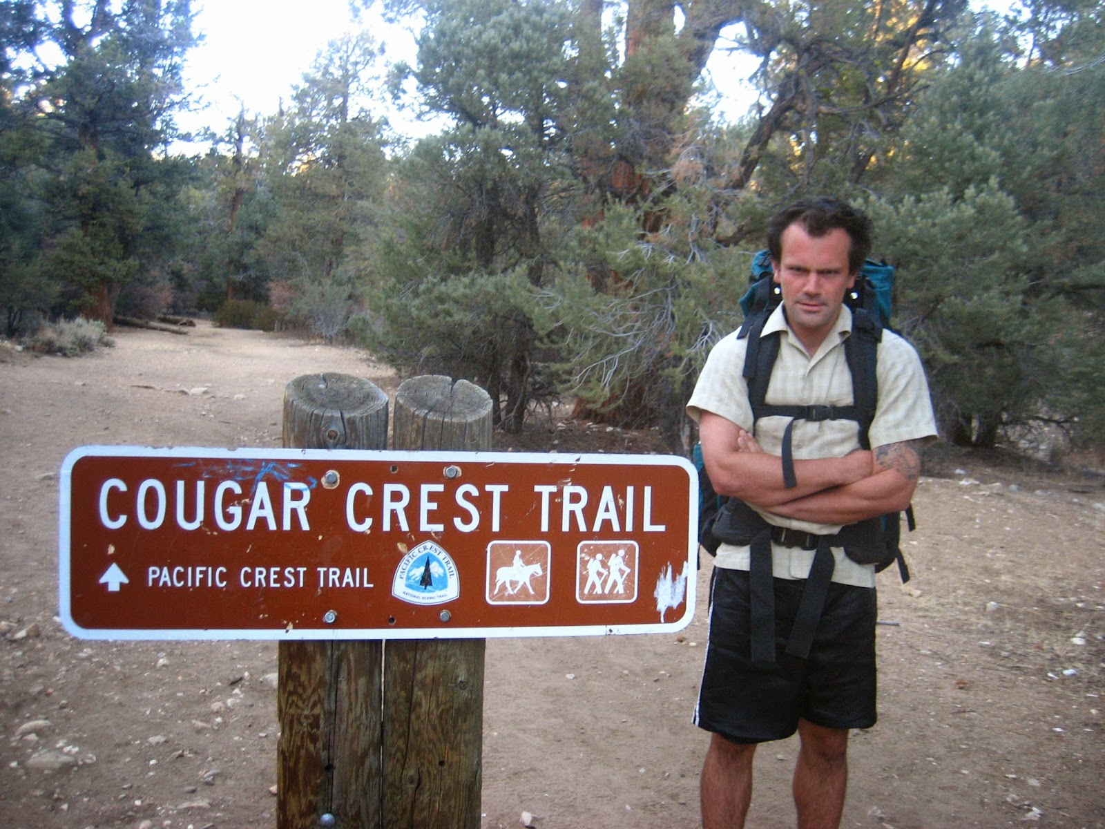
 The trail was closed south of Idyllwild from a forest fire last year. We hadn't figured out a suitable alternate yet. In the spring, most hikers had gotten a ride through this section. A brave few had walked along the road. Our northbound friends had passed along harrowing tales from the trail grapevine about winding roads so narrow that there was no shoulder to walk on and cliffs on either side. We weren't looking forward to that, but we were determined to find a way to walk all of the way to the Mexican border.
I waited in line at the Idyllwild Inn check-out. A woman in front of me was in a huff, telling the man behind the counter indignantly about her hot tub jets, "They kept turning on and off all night, keeping me awake."
"Sorry," the man apologized, not looking sorry, "Why didn't you call the number on the office door? We could have helped."
 |
| Eating pomegranites |
The woman looked miffed, "I wasn't going to change out of my pajamas in the middle of the night to come find someone. And," she added, "there were cockroaches in the cabinet."
"We don't have cockroaches at this elevation, he responded, "and you already have a free nights' stay."
"I have photos," she insisted, and looked down at her camera.
"Sorry," the man mouthed at me.
"Show me the photos," I told the woman, "I'm an entomologist," I lied. They were crickets, but the woman still left in a bustle of resentment, probably mentally crafting her scathing yelp review. I walked up to the desk to ask for advice about an alternate route to the Paradise Cafe.
We set out midday with packs chocked full of food. Our alternate route took us through town, and up a steep neighborhood hill. We passed ranch houses and cabin mansions before finally arriving at a spot where a dirty road departed from the pavement. It was quiet and open, and we could see down into the valley. We walked until the sky started getting darker and we found a flat, sandy spot to set up our tent. We split a pomegranate as the sun set.
 The next day, we followed the sandy road back to the highway and veered south to follow a mountain bike trail parallel to it. The trail dumped us in a vacant campground. From there, we walked on the shoulder of the road while trucks whooshed past blowing our hats off. Cattle ranches lined the highway on both sides. We passed a stream whose bed was a dusty ditch. A little town with a fire department. Trees with shade occasionally, where we say on our packs to eat graham crackers with generous globs of Nutella on top. This is our life.

We reached the Paradise Cafe early afternoon. Outside, a wrinkled old man was singing songs. We walked in, bewildered by civilization. The waitress brought us plates heavy with burgers and fries. The end is close. We jumped back on trail at mile 152 and set off, uncomfortably full, into the late afternoon. I lagged behind Craig, falling ridges behind. We stopped at a water cache for the night. A lone little aspen was planted next to us and we fell asleep to the sound of its leaves shaking percussively in the wind.
The next day was quiet and hot. We saw no people and no wildlife, except for the ever present crows windmilling overhead. The trail was easy and we took lots of shade breaks. I took a side trail to a water source that looked like a fire hydrant with a hose attached to it. It wasn't until later that we realized it tasted like hydrocarbon-infused water. We plugged our noses and gagged down as much water as we had to. We were both delighted to dump the fracking water out when we reached the cache on Chihuahua Road.
 |
| Dinosaur-sized boulders |
We started with the sunrise the next morning, hiking fast into the cloudy, warm day. We started walking into Warner Springs on the trail parallel to the road until we were attacked by sharp hitchhiking seeds. In town, we sat under the overhang of the abandoned gas station, next to the closed resort. The security guard for the (closed) resort kept driving by in his van eyeballing us. The second we walked back to a resort building to fill up our water bottles, he came careening gleefully around the corner on his golf cart (which he clearly had on hand for off road missions) to kick us out for trespassing.
 |
| Sunset in the desert |
We didn't know what the south end of Warner Springs held, but we'd been kicked out of the faucet in the center of town, and we couldn't walk into the desert without water. Luckily, there was an elementary school with a welcoming picnic table and faucet for hikers. We made food while the football team practiced. A group of three girls were sorting recycling next to us when one shrieked, "SNAKE!" and they all went screaming away. I popped up and walked over to the bins. A large skink (a lizard) slithered away, making me jump. The girls laughed, embarrassed at their mistake.
We hiked into dusk, through big beautiful live oak trees. As we climbed out of the valley, the sun exploded on the horizon, leaving a gory mess of pinks and reds bleeding in the sky. It was incredible. We stopped to set up our tent and watch the drama in the sky unfold.
 It was cold the next morning, so we started late. A line of clouds rose slowly from the horizon, stretching from the earth towards us, seemingly pulled upwards like backward blinds, until the whole sky was gray. I made tea to coax Craig our of his sleeping bag and into the day. We ran into a trail crew widening the trail and clearing brush on our long climb. That night, we camped at another cache that amazingly was stocked with water, surrounded by fractious cholla cacti.
 |
| All calm at sunset |
We woke up in the middle of the night to a crazy storm. The tarp started smacking the ground. Sand and rain blew horizontal. Strong gusts whipped through our camp, ripping the stakes out of the ground every ten minutes. I couldn't sleep. We had to take turns venturing out into the storm to restake the tarp.
 |
| Sunrise after the storm |
The next morning, we started slowly, groggy from our long night. The trail dragged us along the undulating ridge of the San Felipe Hills. The path seemed to go on forever, endlessly stretching miles ahead. The highway lay far below, tiny trucks moving noiselessly to and from San Diego. Old cactus friend started popping up, characters from my childhood trips to the Sonoran Desert as we neared Scissors Crossing. Barrel cacti with their curved spines: ironically perfect fish hooks in the middle of a desert. Teddy bear cholla, painfully huggable. Tall, stately ocatillo embellished with spines. Everything with spines, ready to fight for its life.
At the highway, we hitched west into the town of Julian with a woman on her way to bible study. Julian was packed with pie-crazed Eastern European tourists (Julian's known for its pies). We fumbled into a hole in the wall Mexican restaurant, where I inhaled my giant, soggy burrito and endless cups of sweet, cold soda. After a few hours of consumption and electricity, we started towards the edge of town to hitch back to the trail. Another hiker was standing on the corner! Before we could get close enough to see who he was, a semi pulled off to pick him up.
 |
| Trail near Scissor's Crossing |
Craig and I were only at the roadside with our thumbs out for a few minutes when an older woman pulled off for us. She smiled and we smiled back. When Craig opened the door to climb inside, the smell jumped out and slapped us both in the face. Craig pushed aside the cardboard box of rotting fruit to squeeze inside. We weren't in her car for two seconds when our driver sprang to life, talking a mile a minute, careening from topic to topic and from shoulder to shoulder on the road.
She wanted to tell us about her car keys and boss (the bitch) and road trip and daughter (that ungrateful bitch) and astrology. Her mood rollercoastered from gleeful to angry, and all of this on the fifteen minutes it took to get to the trail. We leapt out at the junction, thanking her and hiking off, thankful that the drive had ended safely. Craig turned back to me, "You know she's on meth, right?"
"Huh. That explains a lot," I said.
 We quickly caught up to the other hiker from town. It was our old friend Hop!, another flip flopper. We'd met him in Kennedy Meadows and again in Crater Lake. Hop was as grateful as us to see another hiker, so we decided to camp together for the night. Trouble was, he'd sent home his tent, and it was supposed to rain again tonight. During the storm the night before, Hop had hiked like mad to get to a person-sized cave to hide from the storm. Tonight, we were lucky enough to find a cave-like space under the thick branches of a squat desert tree. The three of us sat together talking in the dark, drinking huge cans of Tecate and eating apple pie with a fork directly out of the box. We are so close.


 We stop at a flattish spot along the trail for the night. The next day, the trail continues to parallel a road over the hill and we near civilization. We pass a cliff patched with plaques memorizing loved ones. At first, I think these are all loved ones that died at this spot, para sailing or something. But there are too many of them! They must be loved ones released into the afterlife at this grand vista in the desert. Ashes to ashes, dust to dust, sand to sand.
 I eat more graham crackers with nutella, sitting on a picnic table in a roadside rest area. Why didn't I discover this snack sooner? At the next road crossing, we decide to take the road into the town of Mount Laguna, where there is supposedly a store. It's quiet, but there is a store, so we buy big beers and drink them on a bench in the parking lot while older tourists subtly avoid us. We are discussing spending the night when Hop comes walking towards us.
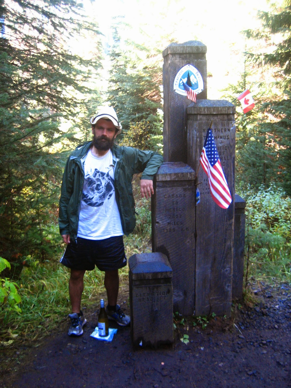
 From Mount Laguna we have 42 miles to the Mexican border, and we'd like to make it there in two days. Hop's friend from San Diego is coming to pick him up and we'd love a ride too. That means we need to start hiking real miles, but even still we do not leave the cabin until almost 10. The trail is easy, and we listen to our electronic devices and walk until it's dark, through the backyards of people, sounding their dog alarms.


