Saturday, June 21, 2014

Mt Whitney to Kearsarge Pass trailhead

PCT MILES COMPLETE: 510.8

PCT mile 770.3 to PCT mile 788.5
Section mileage: 25.8
Days: 6/20 - 6/21

After Whitney, we didn't think anything could possibly top it, but our next day, I was blown away by the transition into Kings Canyon National Park. The hike through the Sierras is defined by mountain "passes". These are low points where you cross over a mountain ridge. We had passes in the desert (ie Walker Pass), but they involved a steep descent to a road, and a steep ascent up a mountain. Passes in the Sierras are the opposite: a steep climb up a ridge followed by a steep, snow-covered climb down. Every day, we crossed one pass, and the first was Forester Pass. The highest point on the PCT at over 13,000 feet above sea level.

We were over a mile into the climb when I realized that Craig had left a bag with my journal in it down by our last stream crossing. I guarded the packs from marmots while he hiked back. For a few minutes I was annoyed. And then it dawned on me where I was: a meadow in the Sierras, with a blissful half an hour of stillness to myself. The sun was warm with a soft breeze. There were blue skies and no mosquitoes. I took out my map and gave each of the surrounding peaks their proper names. When Craig caught up, we continued on our climb.

From Mt Whitney to Tuolumne Meadows in Yosemite (almost 200 miles), the PCT is identical to the John Muir Trail (JMT), and most JMT hikers are southbound. This means that we were suddenly running into dozens of hikers every day.

South side of Forester Pass
Looking south from Forester Pass
The climb up Forester Pass was long and gradual. In a field, we ran into a fearless doe feasting on yellow flowers. The grass gave way to granite boulder fields, and the streams to alpine lakes. These lakes are breathtakingly beautiful; they are these surreal, placid pools of turquoise blue too cold to swim in. Up close, they are full of life. In one, I filtered out hundreds of bright red copepods. As we approached the final ascent of Forester Pass, it seemed impossible that we would be able to climb the sheer rock face. But hidden switchbacks had been blasted into the granite and so up we went, into the top of the world. I can't overstate how much I love climbing passes. Because at the top, you get a view of a completely new world to the north of the ridge. And Forester Pass had the best view yet.

North side of Forester Pass
We thought our ascent was difficult, but it was nothing compared to what the JMT hikers face on the north slope. We started by crossing a snow field. It was afternoon by now, so the snow was soft, which can be not only laborious to cross but also dangerous. Each step, I would slam my heal into the bank to anchor myself before putting my weight on that foot. Even still, occasionally my foot would go plummeting into the slush and I'd be thigh-high in snow. This lovely activity is called postholing. To make matters worse, we have no trekking poles to stabilize ourselves, and I hike in sandals. Luckily, the snow fields didn't cover more than a couple hundred feet since it was a low snow year and we were in the back of the thruhiker "herd".

We had planned to descend that night as far as possible, in order to set ourselves up for a short day into town. We were resupplying our food at Kearsarge Pass the following day. Thruhikers have a variety of strategies for resupply in the Sierras and none of them are easy. There is only one road that crosses the Sierras east-west, and that wasn't until Yosemite. That means that we had to each hike bonus miles over the eastern slope of the range and hitchhike into a town, or mail a bucket of food to a horse pack station and pay them $70 to carry it into their backcountry ranch. We decided on the former. If you're really intrepid, like our friends Spice rack, Hippo, and Thirsty, you can (theoretically) carry all of the food you'll need in the Sierras (about 12 days' worth) from Kennedy Meadows. Either way, we were all hungry by this point.

This means, when several JMT hikers told us that a few trail angels were ahead "about four miles" cooking dinner for hikers, we launched into our rare 4 mph pace, blasting down the canyon. It was more like 6 miles, and we started thinking that the hikers were messing with us. "What kind of people would make that up?" We grumbled to each other. I had three-quarters of a packet of ramen and a granola bar left. That would have to do, because it was getting dark and we were tired. And just when we'd given up hope, we saw a Canadian flag strewn across the path. A man dressed in full Monty costume approached to welcome us across the "border" with snack bags.

Us and Sherpa at the "Canadian border"
Now, what you have to understand is that we were 7.5 miles from the nearest road, across a pass and a 3000 vertical climb. The aptly named Sherpa and his friends had each hiked in 60 lb packs to generously feed hikers for several days, and we were lucky enough to be those hikers. Do you want a quesadilla? They asked. Yes! Do you want some spaghetti? S'mores? Cinnamon buns with messy globs of Nutella smeared on top? Yes! Yes! Yes! It was heaven, sitting around our first campfire of the trail socializing with the trail angels and other hikers.

View from Bullfrog Lake Trail
Spice rack, a lady hiker from Toronto, and Hippo and Thirsty, an extremely friendly young couple from California, and V, a guy from the Czech Republic, also caught up at the campfire. "These JMT hikers told us it was only four miles!" they complained good-naturedly. Hippo and Thirsty pulled out their hand-carved wooden flutes to serenade the rest of us as we drifted off to sleep full of cheese and pasta.

Rainbow over Kearsarge Pass
The next morning, we took the side trail over Kearsarge Pass. At the parking lot, there were MORE trail angels. Former thruhikers Uberbitch and Bristlecone ("cause he's the oldest living thing on the trail!" Uberbitch explained.) had set up at the campground for a couple weeks, cooking for hikers and sending them on their way ("I thought you were hiking to Canada!" they would scold if you stayed for too long). Craig managed to talk a dayhiker into driving us and Tailor the hour to Bishop, a town an hour away with a real grocery store and new hostel with $15 dorms.

Wednesday, June 18, 2014

Kennedy Meadows to Mt Whitney

PCT MILES COMPLETE: 492.6

PCT mile 702.2 to PCT mile 770.3
Section mileage: 84.8
Days: 6/14 - 6/19

We took a day off at Kennedy Meadows to prepare for the Sierras and recover from the last section of the Mojave Desert. Craig had a giant new blister that covered the entirety of the ball of his foot. We left the next day to begin our hike with our very heavy food bags and these big bear proof canisters that are required for food storage in the Sierras. We had planned to slow down crossing the Sierras, averaging 15 miles a day. Still in desert mode, we left Kennedy Meadows at night. That may have been our first mistake. The terrain began to change that night (in the way we expected before Kennedy Meadows). The sagebrush changed into patches of grass (grass!), streams widened from seeps to trickles. We had entered the Sierras, and while we were unbelievably excited to do so, it meant that the path was rocky instead of sandy. We had to stop at a little patch just big enough for our tent when Craig couldn't walk any longer on his mega-blister.

The next day, we descended to a beautiful open valley with a wide river with grassy banks. Swallows swooped along the shore. Our friend Tailor, from Germany, was there talking to an older couple (Izzy and Speak up) and a younger German guy, Zero. Someone had constructed a mini Stonehenge on the shore. We napped for a few hours on the river bank. A group of middle-aged women arrived while we were sleeping. I wondered if they'd read Wild. I wondered if they related to Cheryl Strayed. That's the problem with being a middle-aged woman hiking alone on the trail; people just assume that you're hiking the trail because Oprah told you that was the way to find yourself after your nasty divorce.

The trail led us upwards from the river into the mountains. We played leap frog with a young couple from Colorado, looking fresh. Too fresh to be thruhikers. We found a site at the top of a hill, next to the first corn lilies on the trail. Craig crawled into the tent, and I climbed the adjacent rock pile alone. From the top, I could see off into the distance. It was a moment alone, a millisecond of independence in time for a spectacular sunset. I remember it was cold, and afterward I was suddenly aware how high I'd climbed.

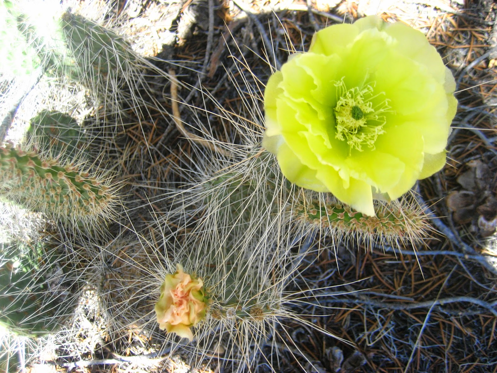
We woke up late. We could hear hikers passing by. I was anxious to move on, the internal magnets all of us hikers have pulling north. And so on we climbed, passing by Tumbleweed I think, who told us to turn around and look at the view from where we'd come from. I forget to do that. This was the Sierras. The flowers are becoming familiar, old friends from a summer I spent doing vegetation surveys in these mountains. "Scarlett gilias!" I pointed out excitedly to Craig, referring to a stalk of bright red trumpet flowers with lacy, delicate leaves.

We climbed up until we were in a real forest of tall, mature pines that felt magical after so much desert. I thought, "the Sierras can't get better than this," and then around the next corner, we had our first view of snow-capped mountains. And the next few days continued in that theme... each climb, each new view became more and more spectacular. Water was no longer a concern. Little snowmelt streams trickled down the path at regular intervals. We'd pass meadows, as though this were a normal thing. "What drought?" we asked. Each new stream, I would take DOZENS of photos. Looking back at my photos, it's clear that this was our main focus.

We continued to play leap frog with other hikers; the couple from Colorado did turn out to be thruhikers, but new ones who had just started their flip-flop hike. A flip-flop hike is what we're doing too. It's any hike that is nonlinear, that doesn't start at a border and end at the other border. We passed by our friends Seahawk, Bumblebee, Kapiko, and Milkman. We ran into Soway (self described "hiker trash") and Little Diablo, who we had last seen our 2nd day on the trail. We passed our first alpine lake. We climbed up past tree line. We climbed so high that the altitude began to affect us; there is less oxygen, and we found ourselves low on energy and nauseous.

We had decided, like most thruhikers, to take a side trail to Mt Whitney. At 14,500 feet, it is the highest peak in the continental United States. And it sits only 8.5 miles from the PCT. A great meadow gave way to the rushing Whitney Creek, which we clung to upwards past the ranger station, where groups of hikers were camped in a grassy field. Up to a lake called Timberline at the timber line (duh) and up up up farther still to Guitar Lake. We were hiking with Tailor at this point, our German friend, when we passed by a ranger. We expected to show our permits and identify ourselves. But the ranger had more sobering things on his mind. "Keep an eye out," he said, "for a man in his 50s. He's been missing since Saturday night."

It was Wednesday. Which meant, although the ranger didn't insinuate it, that they were probably looking for a body. People die on Whitney every year. This man never returned to Whitney portal after climbing the mountain with friends that day. Rescue helicopters buzzed overhead. We would learn later that he must have tried to take a short cut on his descent down the hundred switchbacks down the other side of Whitney. His body was found in a crevice the day we summited.

The sun sank and it was cold in the shade. We climbed to a plateau above Guitar Lake, where tons of marmots were scurrying around. They were totally unconcerned with our human presence. Marmots are the cutest animals- they look like chubby blonde gophers. We fell asleep on the spongy grass with the alarm set for 1 am. We had planned to hike up for the sunrise on Mt Whitney. "You'll be the first people in California to see the sun rise," Seahawk had told us. And as silly a goal as it was, it was also tremendously appealing.

We woke up at 1 am, but only long enough to realize how cold it was. We woke again at 5 am: a much more sane time of day. I impatiently hounded Craig until he was ready to go. I get so EXCITED about climbing mountains. It's like Christmas and the SATs combined. Sometimes I don't sleep well because the anticipation is so great.

The climb from the campsite was almost immediately switchbacks that wound endlessly up the scree.  Halfway up the climb, we ran our friends descending. They had made it up just in time for sunrise. "We tried to give you a wake-up call!" They said.

"Really? We said, "we must not have heard you."

Craig and I on the top of Mt Whitney!
Down they went, up we went. We ran into few hikers on the ascent. It was still too early for most hikers, and it was a weekday to boot. There were a couple of former thruhikers climbing at the same time. "We've been climbing Whitney every year site we retired," they told us. The climb was easier now, but the altitude made it seem harder. We crossed a snow field and then suddenly there was the peak! Capped with a stone hut and a dozen hikers on their cell phones. "Some asshole yelled 'Wake up call!' this morning outside of our tent," one hiker told us. Oops!

The older former thruhikers kissed goodbye and Fix It, the 74 year old hiker, began the climb down. "Where's he going?" I asked.

Tailor on Mt Whitney
"We hike our own hikes," Third Monty said, "doing the John Muir Trail in 9 days is not my idea of fun." Fix It was heading over the top of Forester Pass that same night. Badass.

On the descent, we passed Tailor, Mountain Goat, and Ducketts, all of us grinning like fools.

Thursday, June 12, 2014

Walker Pass to Kennedy Meadows

PCT MILES COMPLETE: 424.5

PCT mile 651.3 to PCT mile 702.2
Section mileage: 50.9
Days: 6/11 - 6/12

At Walker Pass, we were 50 miles from Kennedy Meadows: the start of the Sierras, and (more importantly) the end of the desert. You can hitch 30 miles from Walker Pass into a town, but we had decided back in Mojave that we were going to push on to Kennedy Meadows without stopping. Kennedy Meadows is a "town" of 200 people with just a general store, but they have things that we were extremely excited about: ice cream (me) and beer (Craig). And so we made a plan: hike 50 miles in two days. Remember, we just hiked our first 20 mile day a few days ago, and hiked until 1 am the night before. So this was ambitious.
Topo

There is a long, hot, exposed climb from Walker Pass to Owens Peak (cause that's the way of the desert). We started earlyish, which is to say that we started later than all of the other hikers. We passed Topo, this awesome woman from Missouri we first ran into after Cajon Pass. We passed Dr. Fierce who is hiking with his mom and best friend, Church Lady (three more of our favorites). It's a good thing we had decided to hike through the day, because there wasn't any shade anyways.

Owens Peak
The mountain was gorgeous; it was burnt, but the views into the valley were incredible. You could see way down into the valley, where there were these alien-looking crop circles in a completely arid landscape. As far as we could see, it was sandy brown with the exception of this irrigated landscape. And the craziest part is that that is common practice out here; the Central Valley of California grows much of our country's produce, and it is a DESERT.

The wind was strong and the sun was stronger. The trail led us back down into Joshua tree land, where we ran into some unknown hikers and our friend TinTin. TinTin is one of our favorites - she's this awesome independent woman in her 20s from France. She had gotten off the trail at Walker Pass to go into town to a hospital; the infection from a spider bite was spreading down her arm. She got her trail name because of a spontaneous new haircut that Church Lady gave her at the Saufleys.

Crop circles in the desert
We've climbed another small peak in the now suffocating heat, following the ridge to a glorious spring in the side of the mountain. It was lush with plants and bird life despite being just a trickle; there were even mosquitoes! We made a pot of coffee and set off into dusk to climb yet another peak. By the time we set up camp for the night, we had come 30 miles and climbed 5000 feet.

We woke up early (actually early) the next morning, in eager anticipation of the ice cream and beer we could have if we hiked 21 miles before the store closed at 5 pm. We were expecting a single climb followed by a long descent, but we were not expected a burnt, exposed landscape. All day we were under the relentless sun, which chips away at your motivation and enjoyment of hiking/life. We found shade only once, where we made coffee. We stopped again at the shallow Kern River for a swim, which we'd anticipated nearly as eagerly as Kennedy Meadows.

By the last four miles, however, we were driven to the brink of madness by the sweat pouring down, lack of water, and these bastard deer flies with orange eyes that circled relentlessly. It was endless hills of sage brush, and I swore as creatively as I could at the flies, telling them the horrible things I would do to them and their offspring. There is nothing that I hate more than deer flies. All the while, the sound of cicadas was this deafening SHHHHHH loud enough to drive you mad. We'd been expecting (unfairly, perhaps) that the transition from desert to Sierras would be more dramatic. That we'd round a corner, and there would be a real meadow (grass, not sagebrush) framed by majestic snow-capped mountains. And here we were, still in the desert, hiking in the middle of the day's heat.

And then, finally, we were approaching the store. All of the hikers (DOZENS) started clapping and cheering as we walked up. And the grumpiness dissipated. They had ice cold cans of Squirt! And Ben and Jerrys! And all of our friends, and people we had never met, were there and excited to see us. Kennedy Meadows may not be a meadow, but it was everything else we could have hoped for.

Tuesday, June 10, 2014

Mojave to Walker Pass

PCT MILES COMPLETE: 373.6

PCT mile 558.5 to PCT mile 651.3
Section mileage: 93.6
Days: 6/5 - 6/10

Mojave!
Before leaving Mojave, we loitered at Dennys for several hours (because loitering is what we do), drinking milkshakes and calling home, waiting for the sun to lower just a little bit. We finally hitched out of town with a man who had lived in Mojave for 40 years. I asked if the city had changed at all, with the development of all of the wind farms. He said, "I don't know what to say to that," and that was that. I never really understood why people made such a big deal out of wind turbines going up in their backyards until now. They are just such a landscape feature. I mean, it's not mountaintop mining, but I understand why people care.

We walked into the evening through more wind farms and past the highway. Craig and I walked by ourselves and I made up songs. At one point, Craig walked within inches of a foot long Mojave green rattlesnake without noticing. The locals call them one-two snakes, cause "that's how many steps you get when you're bit." We slept by the highway next to the silhouette of a Joshua tree.

Mojave green rattlesnake
The next morning, we began the climb up from the road, coming across Shiny and Half double, a sweet couple. The wind was blowing furiously at this point on the ridge, and they had hunkered down in a little grove of "trees" the night before. On the ridge, we ran into a full grown Mojave green, that was coiled up and rattling at us. I've seen rattlesnakes before, but apparently had never heard them rattle. Cause they are seriously loud. Not at all subtle, and pretty much impossible to mistake with cicadas or any other creatures that make SHHHHHH sounds.

Show down with the trail cattle
We found a little grove of trees at the top of the ridge to hide in for the day. We read Cadillac Desert, which is a classic book about water issues in the arid west. It's a fitting companion to this hike, especially in an extreme drought year. It's impossible to overstate how important water is to us in the desert. There are 30 mile sections of trail with no natural water sources, and this year ordinarily running springs are bone dry. That means that we have to carry 5 liters of water at times (that's 10 lbs) and most of us night hike to avoid the heat. You can get by drinking less water at night. All of our friends from the previous section passed by while we waited in the shade, stopping to talk and update us on their adventures in Tehatchapi. We left at 6 or 7, nighthiking into a real grove of big Jeffrey pine trees. We slept on a bed of needles when I felt like I was sleepwalking; I've never been good at staying up late and the trail is no exception.

Maybe we're out of the serious desert, we thought foolishly, in the morning. We stayed under the pines for our short morning hike, and got water at a spring gushing with water. The day before, our friends had told us that a trail angel that they met had told them she'd be back with magical fruit and bagels at a road crossing. We shamelessly planted ourselves in the sap soaked ground under pine trees at the first road crossing. We had to wait out the heat somewhere, after all! Dirt bikes roared past every few hours. The hours waned, and we moved with our migrating patch of shade. No magic, just another day of trying (and failing) to sleep. I was anxious to get moving and Craig wanted to wait until it cooled off. This happens everyday; I guess this is compromise! We hiked into the night again, finishing our first 20 mile day in a patch of dust.

No trees
The next morning, we woke up to some belated trail magic; a refilled water cache with 2 Coors lite cans for breakfast! Craig hiked like a monster on the breakfast beer! It's a good thing that the morning started so great, because the rest of the day was pretty awful. We'd descended into the desert again. Even the shade of Joshua trees was gone. And it was HOT. I was just as relieved as Craig to hide from the suffocating heat. The problem was finding a place to hide. We pushed through to Pinyon Mountain, where there were (not surprisingly) pinyon pines, which are these hardy, shrubby trees that suck for shade. We had to move three times, first hiding behind a rock then some little trees. We were on a steep trail on the side of a mountain, so we only had a path 2 feet wide to lay on. For 8 hours. It was too hot to read, too narrow to sleep. It was awful.

We left at night to hike again. The trail wound up and down hills, and we hiked fast, dodging the scorpions and Jerusalem crickets and spiders that are common on the trail at night. These critters are fierce; these half inch scorpions flip their stinger up when you pass instead of scurrying away. We're in "stand your ground" territory.

Jerusalem cricket
I thought I saw a headlamp at one point in the distance, but couldn't be sure. I get so tired at night when we're hiking that sometimes it feels like I'm swimming through the world instead of walking. But this time, I was right, and we caught up to Steve at an ATV road where he was setting up his tent. He had wild hair and wide awake eyes. We stopped to talk for a little while. He's a college professor from Pennsylvania with a mild hiking addiction. He started around the same time as us from the border. "I don't hike fast," he explained, "but I can't stay still," so he doesn't take zero days (when you hike no miles). Ever.

Scorpion
We hiked a few miles farther to the water cache, where we made pasta with a BRICK of asiago cheese and fell asleep quickly.

The next day was pretty much the same. Early climb in the early morning heat. Day in the shade. Reading. Night hiking fast, until I felt like I falling asleep standing up at 4 mph (that's fast, especially for me and my little short legs). We hiked down to Walker Pass campground to get water. We were out and exhausted. Sitting at a picnic table was a collection of jugs of water (yippee!) AND GATORADE! Yogi, who is this trail-famous person who wrote THE PCT guidebook, had left the Gatorade for us hikers. We slept in the horse corral at the campground, which was the only place soft enough for my tent stakes.

Wednesday, June 4, 2014

Hikertown to Mojave

PCT MILES COMPLETE: 280.8
PCT mile 517.0 to PCT mile 558.5
Section mileage: 41.5
Days: 6/2 - 6/4

Mountain Goat, me and PUPPIES!
We woke up to a the broken record of a rooster crowing extremely close to our tent and the hot sun shining directly on the tent. We hastily packed and retreated to the "hiker lounge" which was a garage converted into an open air hang out. It was already too hot to hike. The table was overflowing with hiker boxes. A few other hikers who had spent the night were preparing to head out. Not us. We wedged ourselves into old couches, slapping at flies.

Other hikers pulled up in vans, arriving from the Anderson's and opting not to hike the roadwalk. The massive hiker boxes got fuller as thruhikers picked up packages at the little post office. It wasn't a real post office. Because Hikertown isn't just a hostel. It's a fake old western town constructed from plywood and trash dump discards, situated in the middle of a run down town of dust in the desert. A herd of dogs roams the yard. A brand new litter of puppies lived in the "Sheriff" part of the town. A herd of alpaca lived next door. It was without a doubt, the strangest place that I have visited on the trail.

Walking the aquaduct!
We left town at 7 to walk along the LA aquaduct for the night. It is a completely flat, exposed section of trail that follows first the open water then the giant metal pipe that leads from the snowmelt fed rivers in the mountains across the desert to the thirsty, thirsty metropolis on the coast. We were punch-drunk tired, and started to listen to music. At one point we started a mosh pit (of two) on the trail. We walked towards red blinking lights on the horizon by the light of the moon. We kept pace with two speedy hikers, Handy Andy and Spencer, for a couple hours. They started on the same day as us, at the Mexican border, and have been averaging 30 miles a day. On a diet of maltodextrin and candy, primarily. They sped past us on a break. Soon after, we past them camped by the road. "Do you want some candy?" they called to us. And loaded us down with SO much candy, since they will be ahead of schedule to their next resupply.
Turbines and Joshua trees!

We feasted on milky ways under the milky way and stumbled a few miles farther to a tank of water set up as a hiker cache and almost empty.

The next morning, we woke to the sun already unbearably hot shining down on us. Across the aquaduct, we waved to Seahawk, Bumblebee, and Milkman. As we packed up camp, other friends arrived (Ducketts, Eleven, Mountain Goat, FedEx, Stealth). It was hot and exposed, and we had a half day of walking to the next water source. The landscape was full of wind turbines creaking as they awoke, just like us, and bizarre Joshua trees. The red blinking lights the night before were on the turbines, and we were now the edge of a giant wind farm.

All of us hikers stayed close for the day, hugging close to little pockets of shade behind wind turbines and little desert trees. We spent most of the day under a rare shade tree by a little "creek" which was really just a trickle of water just big enough to cover my feet and fill our bottles.We waited and napped in the shade until dark before heading up the ridge. At the peak of the unknown, unnamed mountain, at the water cache, there were about a dozen hikers at 11 pm. That's how it is in the desert: water sources become social places, since we're all tied so intimately, so vitally to water.

The next morning, we climbed down from the ridge past still more wind turbines in the heat. This morning, the turbines were already swooping to life. Our route took us to their bases, close enough that the wind turbine blades generated wind themselves. I felt tiny and weak, cowed by the power of sun and wind. Like this strange little fleshy bag of water that the desert would kill in days not weeks if I somehow got lost. It was a shifty morning, even though it was a town day. I made the mistake of pooping on a red ant hill. But sometimes it feels like the whole world is an ant hill out here! I dug a hole, and they began to pour out mid-poop. It was pretty distressing, to put it mildly.

At the road, we had the option of hitching west to Tehatchupi or east to Mojave. We chose Mojave, because it's a compact town. And all we wanted was to resupply at a grocery store and drink margaritas by a pool. It took about an hour to get a ride into town. We watched countless trucks moving water driving past, on their way to the solar farms, to help control the dust that blows over the giant panels. We were discouraged and grumpy, standing in the sun and wishing we'd just gone to Tehatchupi like all of our friends. They were probably in a movie theater by this point, bathing in air conditioning so cold it hurts and eating giant buckets of popcorn with fake butter drizzled on it, watching the X-Men movie. 

A man finally picked us up and dropped us off in the hot, steamy, depressing/depressed town of Mojave. We got nachos and checked into the motel 6. I met a man at the hotel with a Trumpish shag of blonde hair. He told me that he photographs thunderstorms, and gave me laundry detergent. Trail magic comes in all forms. We had burgers and watched TV and drank Budweiser brand mar-beer-itas by the pool. It was perfect. We even ran into Tintin and Tailor at the hotel.

Monday, June 2, 2014

Agua Dulce to Hikertown, USA

PCT MILES COMPLETE: 239.3

PCT mile 454.5 to PCT mile 517.0
Section mileage: 47.2
Days: 5/30 - 6/1

When worlds collide at the Saufleys
We left the Saufleys while a film crew was recording scenes for an episode of The Bridge, in which a psychopath was holding up in the Saufleys' house. The funny part was that the actor who was playing the psychopath looked like a clean version of a PCT thruhiker. It was wait-for-free-tacos or hit-the-trail. After much debate (and a dozen thruhikers' faces staring at the taco grill through the van window), we chose to hike at dusk. We nighthiked for 5 miles with Pigpen, before heading off on our own up the hill. The headlamps of the other hikers got smaller and farther away as we climbed the mountain. We walked through the desert meadow, wondering what it looked like in the daylight. Wideset eyes glowed in the distance. Too tall and widely-spaced to be a cougar, too big to be a deer. I yelled and it prodded down the hill on hooves.  Big hooves. Elk or big horned sheep? We kept moving. We passed a fox later in the night. An owl. Each time suspecting first that the sounds and eyes were mountain lions. We hiked 11 miles before curling up next to the trail around 1 am.


The next day, we hiked down to the fire station. Hidden in a grove of shrubby oaks guarded by a plastic Frankenstein statue, we discovered the Anderson's water cache and SODA! I sat under a painting of a clown drinking sweet bubbly nectar of the gods, talking to Polaris and FM. We trucked on into the heat of the day. Eventually the trail began to zigzag downwards toward the road. Safe in the shade of a picnic pavilion, Craig said, "We're not hiking during the day again."

We tried to nap. A hiker named Prometheus was dropped off at the pavilion with a bag of Chips Ahoy cookies. He wore real leather boots, a felt jacket, and a little knit beanie and carried a big wooden staff. He looked, at first glance, like a caricature of a hiker. Like, tell a 6 year-old kid to draw a hiker, and it would probably look like Prometheus. He was happily drunk and planned to eat his cookies and then start the road walk detour. He was from, of all places, Plattsburgh, land of Franklins.

Mrs. Anderson swung by with Peanut in her van! We finally left the shelter at 7 pm to strike out into the world evening and night hike, bound for a bar 8-10 miles away. Almost immediately we ran into Rock Ocean, a tall bearded trail angel with a blissful smile. He is following our hiking class northward and offering rides into towns.


On our walk, we saw horses, a lake that stank of Loch Ness feces, messages from other hikers written with trekking poles in the sand. Thank You was written in pipe cleaner on a chain link fence. "You're welcome!" I thought. At long last, we heard music and saw lights. Then voices. A large stone building loomed ahead: the Rock Inn. It was full of locals, with a band playing Creedance covers. A whole table of thruhikers was already there. A big biker and his lady, in high waisted jeans and too much lipstick, challenged a couple hikers to pool. They had bottles of Black Butte porter! I have never been so happy.

We asked the waitress about camping, "is there a bridge we can sleep under?" She directed us to a strip off burnt down Forest Service cabins by the lake, unfortunate casualties from the recent fire that also led to the closure of the PCT. She warned us, "The owner of the property across the street gets drunk every night and will threaten you with her shotgun if you trespass."

Our campsite, obviously
With her words in mind, we all tiptoed across the street by the red glow of our headlamps and cowboy camped on the foundations of old cabins.

The next morning, we stopped after a few miles to hike in the shade of a few big live oaks and napped for several hours. The other hikers were long gone. A man in his 50s pulled up a pick up truck. "Do you want some tea or beer?" he called to us. We popped out from the tent. The first thing I noticed was the gaping hole in his ear. It was the size of a quarter. Only a few teeth remained.

Steve handed us cold Coors Light and we sat on the bed of his truck and chanted. "That's my best friend Peanut" he explained, referring to an overweight min pin, "She doesn't tell where I've been or what I've done". Steve talked about his giant patch of artichokes and adventures collecting pinenuts. He pulled an old boot of the cab, and dumped out a big pile of pinenuts for us. He even gave us his old Leatherman pliers to crack them open. Steve left us with a couple more cans of Coors, saying, "it'll keep me out of trouble."

Craig becomes a celebrity
We were packing our bags and prepping our feet for our evening hike when another car pulled up. A tall man with a big camera approached us. He was a Norwegian living in LA, out for the day working on a photography book. He's trying to capture life on the San Andreas Fault, using photographs to explore why people settle there with the certainty that someday soon, an earthquake will rip the earth in two. He had never heard of the PCT. "Can I take your photographs?" He asked. "Sure," we said and awkwardly posed trying to channel American Gothic and not giggle. He got really excited when he noticed that Craig's feet were wrapped in duct tape and took 50+ photos of them, laying on the ground for a more artistic angle. "Hiker foot fetish pornography," we joked later.

We took off into the silver sun, following it westward as it waned golden the sunk beneath the hills.  We passed a wolf rescue. The wolves ran towards us in a pack, howling. An emu farm. A barn with huge pink letters spelling, "KEEP OUT". A Buddhist retreat. The sun was gone. We kept walking until we reached the highway. Craig's feet were in pain. A lot of pain. We hiked a half mile at a time, stopping for five minute breaks until the pain would subside enough to continue walking. We finally arrived at the hostel, Hikertown, after midnight. Dogs barked and the manager came to let us in.